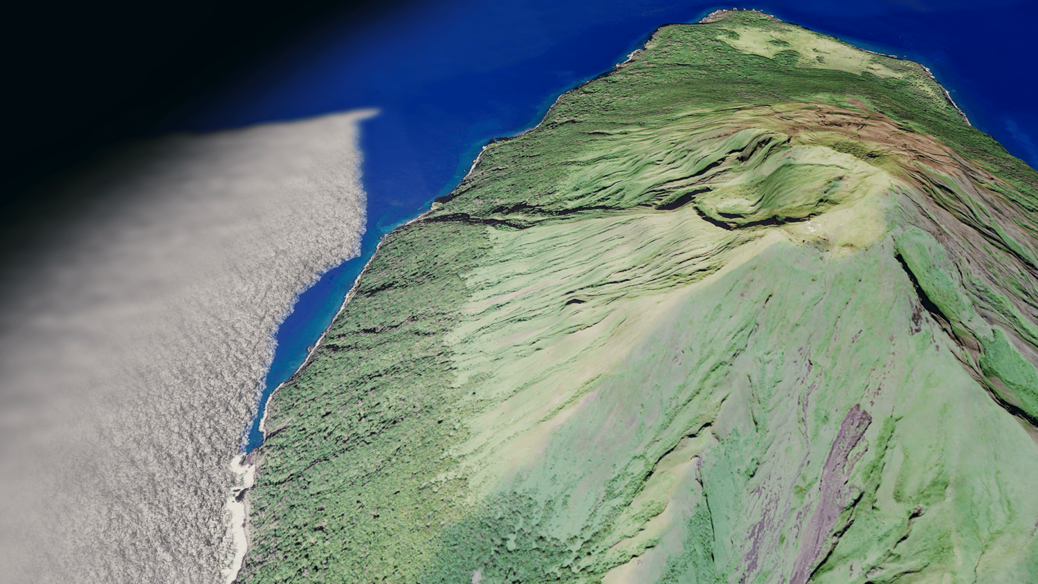
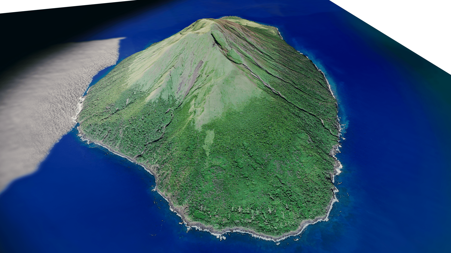
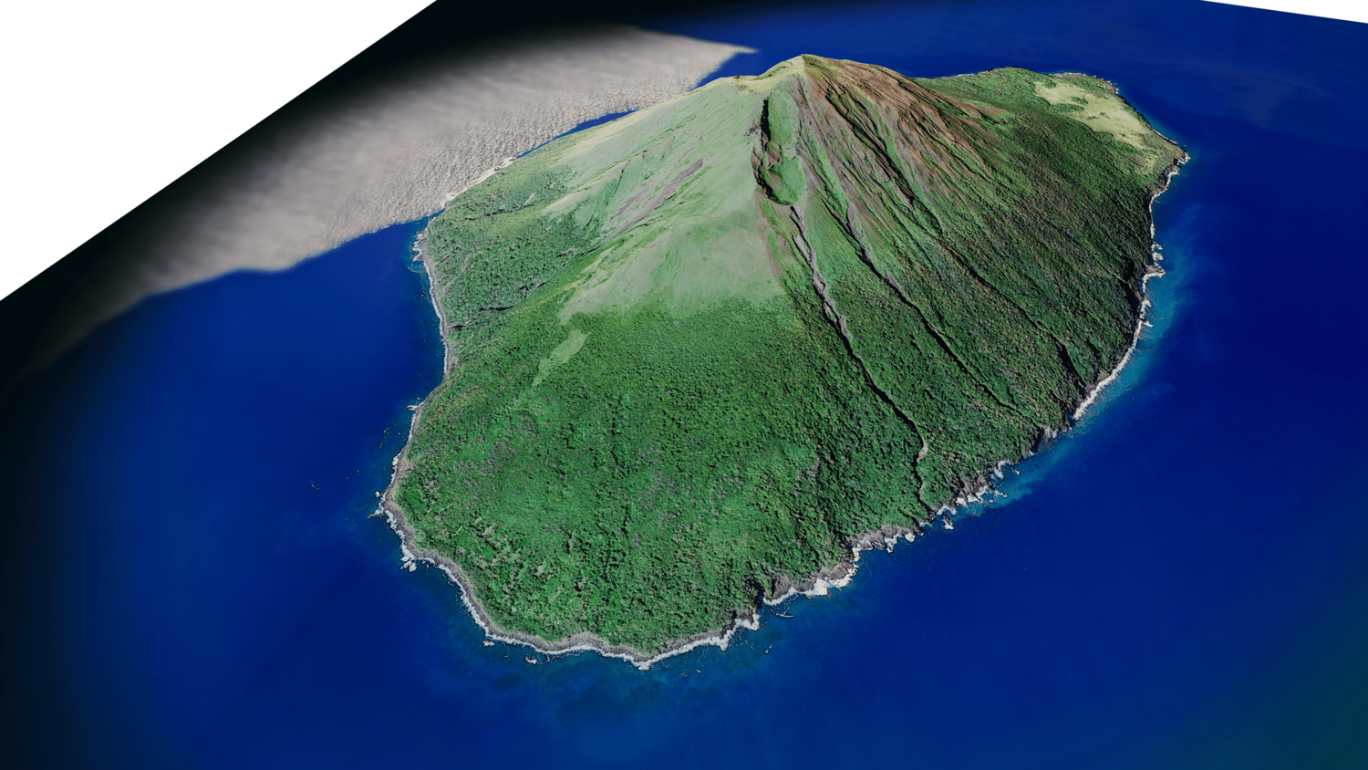
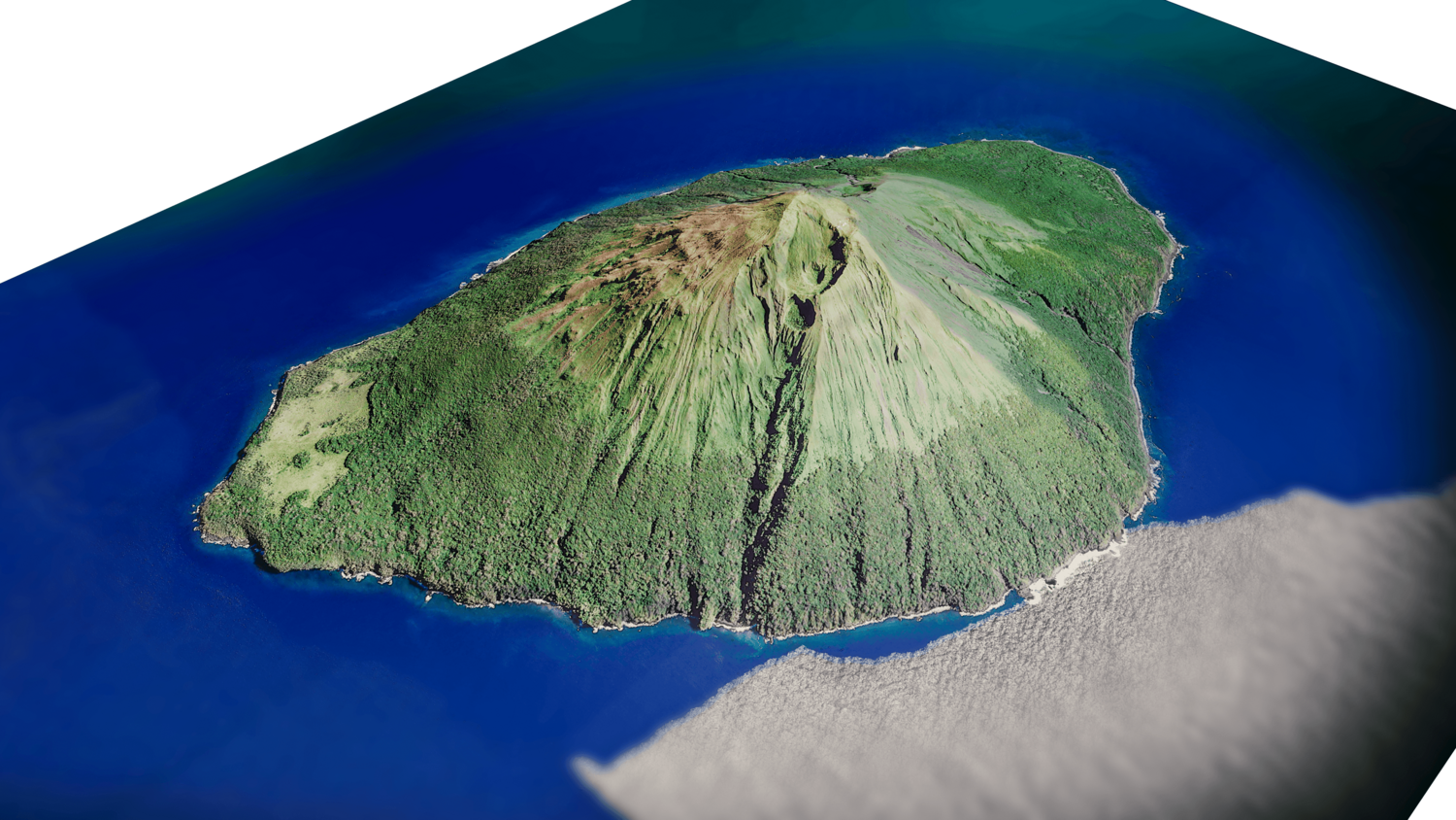
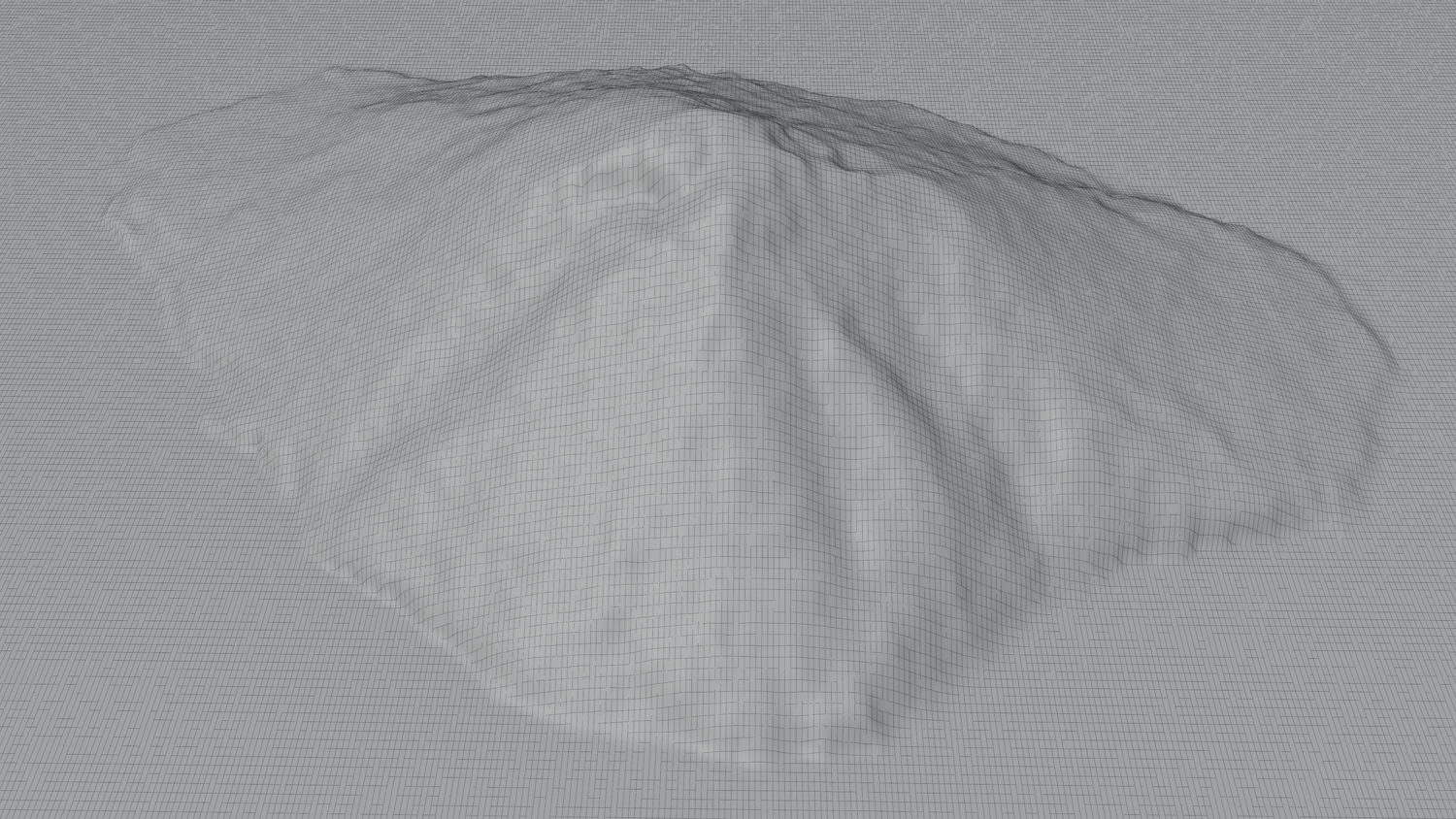
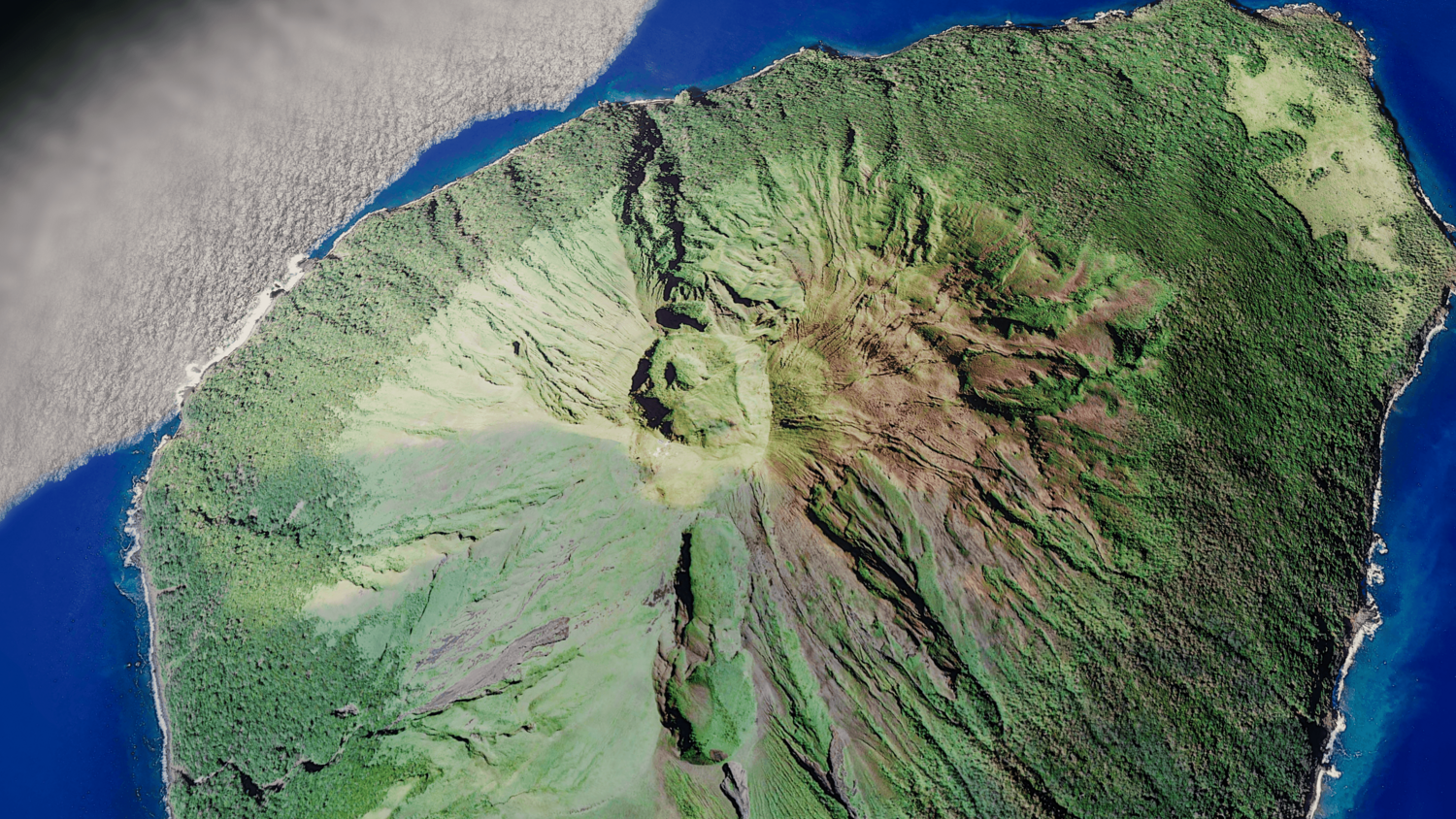
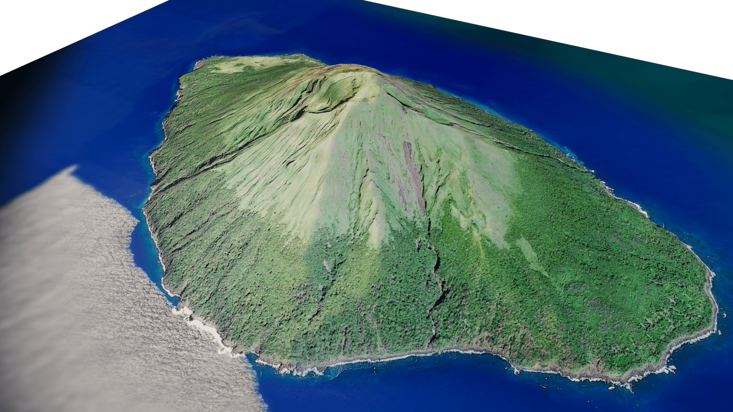
Kao Island 3D model terrain
Kao Island 3D model terrain. 3d model island of Kao and with its landscape of mountains, beaches and forests.
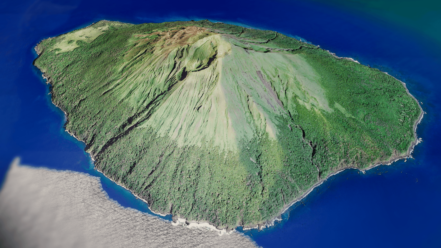
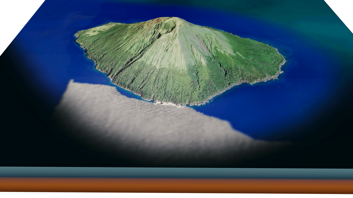
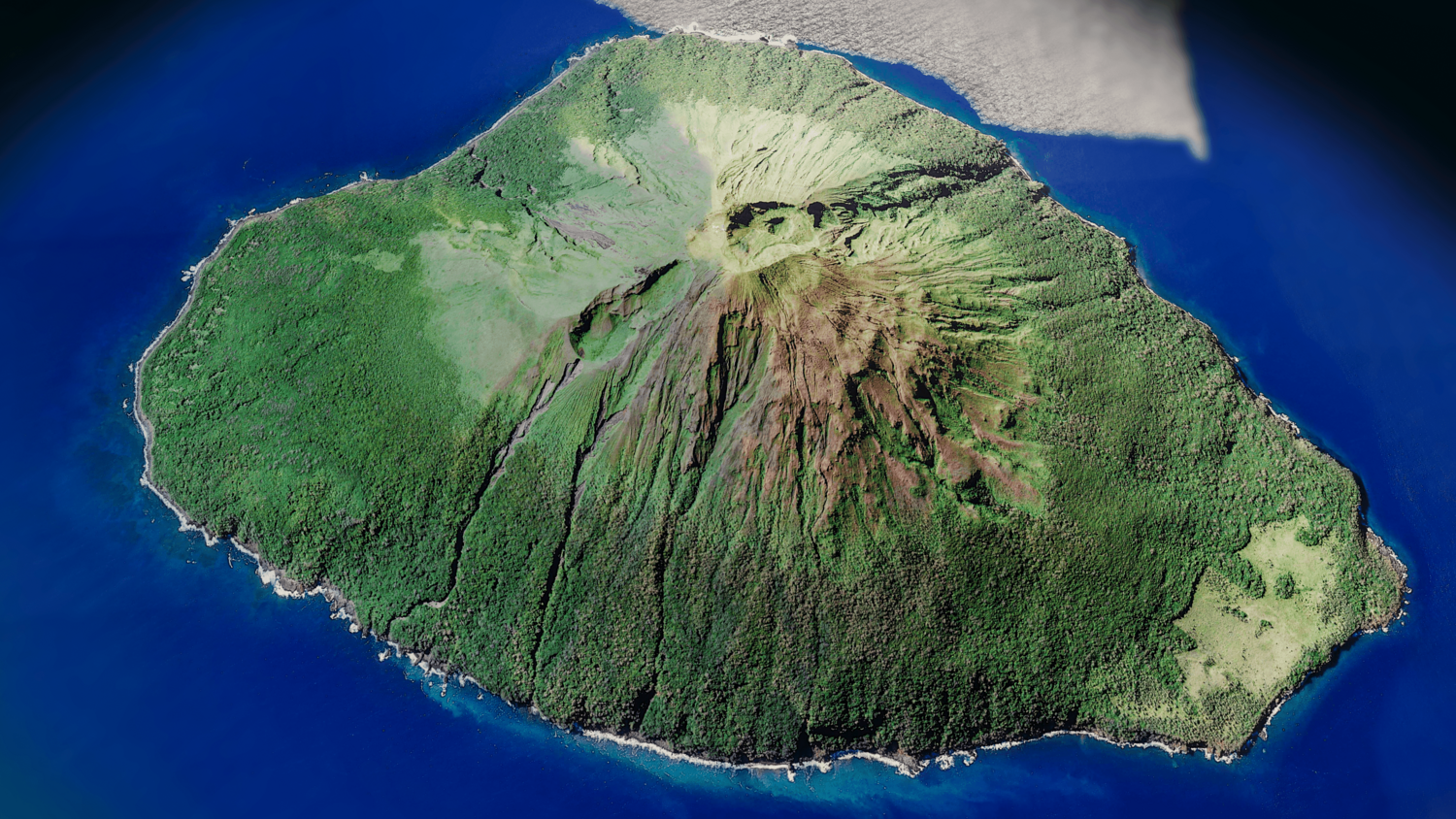
3d model landscape of Kao Island , Tonga Islands, Caribbean Sea, Pacific Ocean, Kingdom of Tonga.
High Poly mesh High detailed model
with 8K textures - Diffuse map - AO map - Displacement map - Normal map - Roughness map
The Blend file do not require the displacement, but you can still use it if you want to create other terrain model yourself
texture example from the Kao Island , Tonga Islands, Caribbean Sea, Pacific Ocean, Kingdom of Tonga. Kao is an island and stratovolcano in the Haʻapai island group of Tonga. It lies about 6 km north of Tofua island and reaches 1,030 m above sea level, the highest point in Tonga. The slopes of the island rise at angles exceeding 35 degrees to the summit, which has a series of small volcanic craters.
You will get 6 files
All files previously purchased will always be available for download in your Library